Portfolio
Projects
Pick a project to read the full case study — each card shows the theme it tackles and the skills behind it.
SideQuest · Personal UX Case Study
Sustainable Seedlings
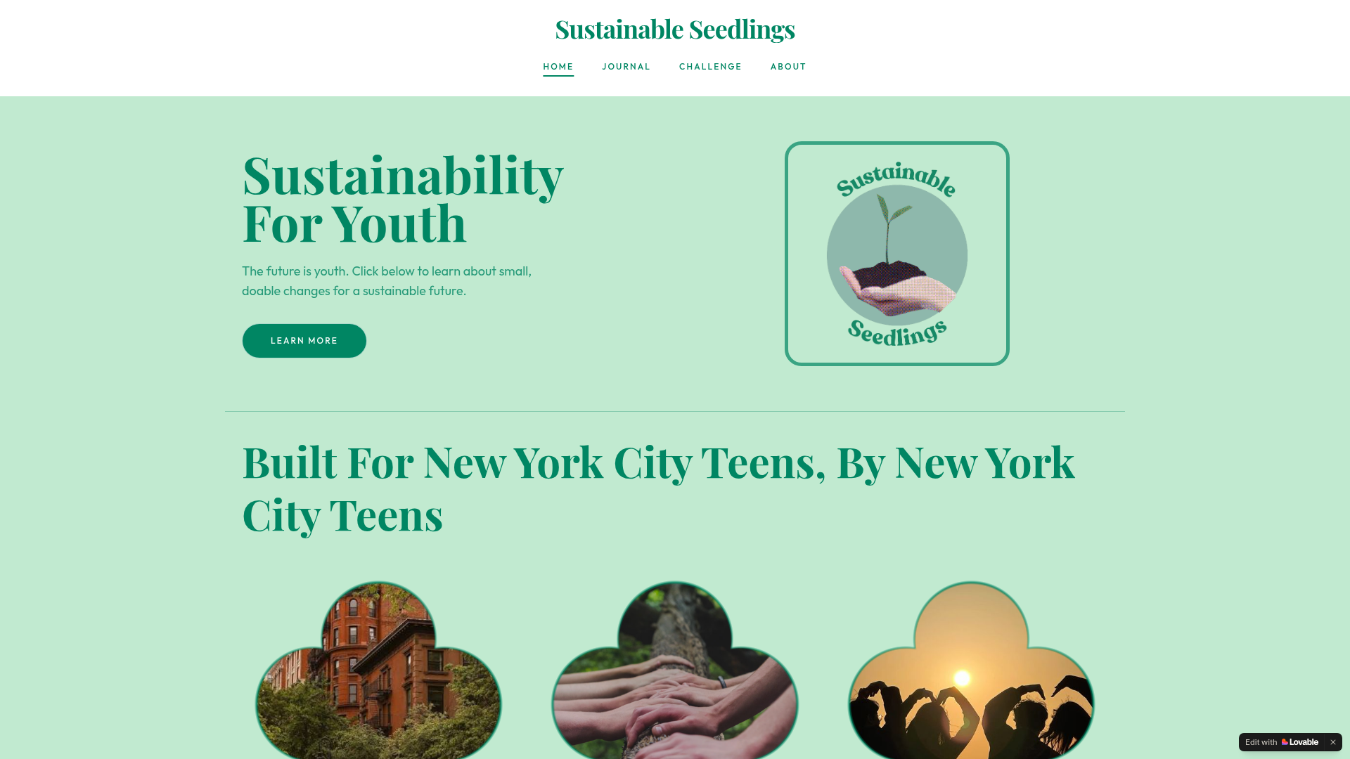
A blog and 30-day challenge that makes small sustainable habit changes feel doable for young people.
The Challenge
Young people aren't getting clear, accessible information about how to live more sustainably — and the resources that do exist don't speak to them. There's no simple, youth-friendly guide that shows just how easy sustainable transitions can be, or why they matter.
What I Built
An online blog and 30-day sustainability challenge built to make sustainable habit changes feel easy and intuitive for young people. The site includes four educational blog posts (sustainable shopping, gardening, at-home swaps, and sustainable role models) plus a day-by-day challenge anyone can follow to reduce their environmental footprint.
My Role
Solo project — research, content strategy, UX writing, graphic design, and site build using Lovable and Canva.
Skills Used
Research · AI Literacy · Graphic Design · UX Writing · Content Strategy · Web Development (Lovable)
What I Learned
“From this project, I learned about the harsh truth behind much of my consumption, and the exploitative labor that goes into making the clothes and material goods I love. This has guided me to be more mindful of my consumption and shopping habits, something I struggled with before.”
Impact
Published website, open to public use globally. Presented at EcoPower '26 Community Report Back.
Group Project · EcoPower '26 · UX Case Study
Infrastructure Walking Tour of The Flats
A phone-first GIS map and self-guided walking tour of The Flats — energy infrastructure, green space, markets and historic sites, annotated as stories instead of coordinates.
In partnership with Ground3D (Wil and Zoe Voss Lee)
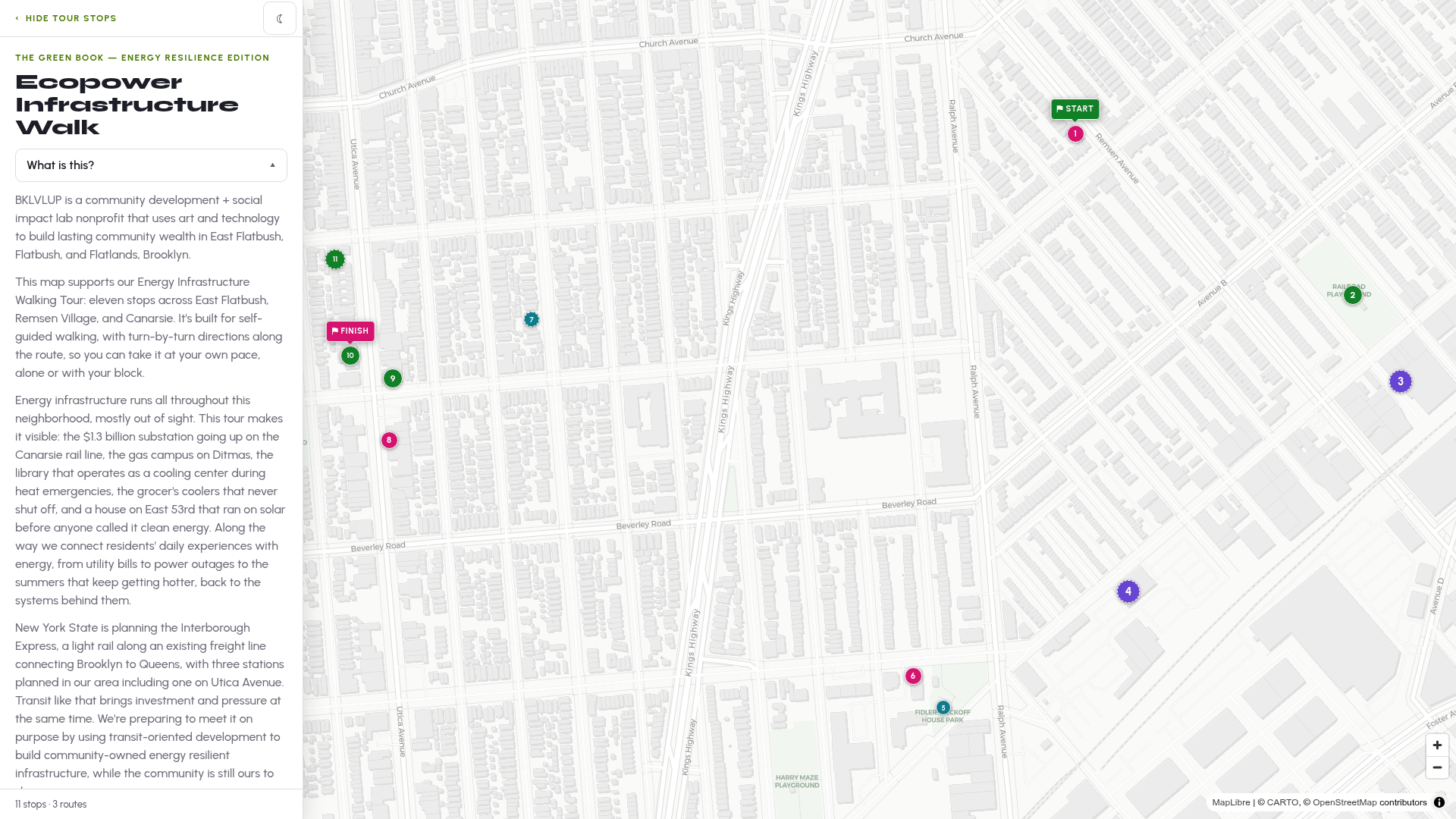
Ground3D built the published Energy Infrastructure Walkshop map — The Green Book, Energy Resilience Edition — from the mapping, annotations and field work our team contributed: eleven stops across East Flatbush, Remsen Village and Canarsie, built for self-guided walking.
The Problem
What isn't documented can't be defended. The Flats holds a 40-year-old Caribbean market, a playground with roots in the 1990s, energy substations serving thousands of residents, and green spaces most people walk past without knowing what they are. When gentrification comes for a neighborhood, it comes for the things nobody wrote down first.
Who It's For
Residents of East Flatbush standing on the sidewalk with a phone — not planners reading a report. That framing set every decision: mobile-first, no login, no jargon, and written so each stop feels like a story you can walk to.
My Role
I contributed the GIS mapping on the Felt platform — adding location data and field notes for infrastructure points across The Flats — and worked directly with Ground3D on map point formatting and description writing. I also researched the role of cooling in the Community Resilience Hub context.
The Finding That Shifted Priorities
Heatstroke is the leading environmental cause of death for New York City seniors. I flagged that as a design priority for the Resilience Hub — it moved cooling and elder access from a nice-to-have to a must-design-for.
Design Decision
Every map point was annotated in full narrative sentences rather than bullets, a decision drawn from studying Ground3D's Roots & Rhythms map. The test was simple: could someone open this on their phone and take a self-guided tour with no explanation from us?
What I Discovered
“This project really helped me learn about the rich history of East Flatbush. Prior to completing the map, I had no idea Brooklyn's oldest building was located right in East Flatbush!”
Outcome
The map is live and navigable from any phone, and it anchors the in-person Infrastructure Walking Tour in East Flatbush. Next comes community pact outreach — signing up businesses along the corridor as climate emergency resources for the Flats Rising Communication Strategy with Ground3D and NYC OEM/COAD.
EcoPower '26 Track Projects
The four projects our cohort delivered
Every Operator contributed to all four. The highlighted project is the one I'm credited on as a primary builder.
Infrastructure Walking Tour of The Flats
Environmental & Data
Felt GIS mapping, location data and field notes, cooling and heatstroke research, map point formatting and descriptions with Ground3D.
Belle, Adela, Jiaer, Krissa, Victoria · partner: Ground3D
Community Resilience Hub Survey
Community Research
Cohort-wide support: survey design input, street outreach and synthesis of resident responses.
Led by Jiaer Li, Adiba Islam, Mohamed Ali Salhi
Emergency Readiness
Preparedness & Storytelling
Cohort-wide support: field research, signage activation and community interviews.
Led by Adiba Islam, Carlisha Grant
Powering the Block
Energy & Infrastructure
Cohort-wide support: infrastructure research and data collection across the corridor.
Led by Krissa Williams
Field Work
Additional Work
Workshops, street interviews and conferences from nine weeks with EcoPower '26.
Participated in equity-centered design thinking workshop — used FigJam for community research synthesis and prototyping
Conducted street interviews in East Flatbush collecting real community stories about infrastructure and emergency weather support
Spray-painted Rain Activated signage with hydrophobic paint in East Flatbush to spread flood preparedness awareness
Attended Brownfields revitalization conference at NJIT — networked with established environmental professionals
Connected with professors at Swarthmore College and Medgar Evers College on youth environmental education equity
Co-designed a community data intake survey for The Flats